

The Hidden Costs of Poorly Mapped Parcels: How Inaccurate Land Data Undermines County Governments
/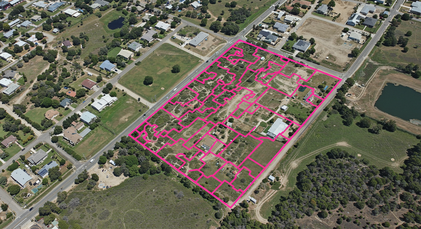
Poorly Mapped Parcels
In the era of digital transformation and data-driven governance, one critical but often overlooked area is the accuracy of parcel mapping. Parcel maps—detailed diagrams showing the boundaries, ownership, and sometimes usage of land plots—are foundational to the operations of county governments. From tax assessment and infrastructure planning to public safety and land use policy, accurate parcel data underpins nearly every county function. When this data is flawed—whether due to outdated records, imprecise boundary mapping, or misaligned GIS systems—the consequences can ripple far and wide.
Revenue Loss Through Inaccurate Taxation
At the core of county finances lies the property tax. Misaligned parcel boundaries or incomplete ownership data can lead to incorrect property assessments, causing under- or over-taxation. Undervalued properties reduce county revenue, while overvalued ones increase the risk of legal disputes and taxpayer dissatisfaction. In some cases, entire parcels may go untaxed because they are not correctly recorded or linked to an owner in the system.
This not only creates budgetary shortfalls but can also erode public trust in the fairness and competence of the local government.
Planning and Zoning Complications
Urban planners and zoning officials rely heavily on parcel maps to make informed decisions about land use, development approvals, and zoning enforcement. When parcel boundaries are incorrect or out-of-date, development can encroach on protected areas, utility easements may be overlooked, and zoning violations can go undetected. These errors lead to increased permitting conflicts, project delays, and in some cases, costly legal challenges between property owners and the county.
Infrastructure and Public Works Inefficiencies
County governments manage a wide range of public infrastructure projects—road maintenance, sewer systems, utility routing, and more. These projects depend on precise parcel data to identify right-of-way access and ensure accurate placement. Poor mapping can lead to construction errors, trespassing on private property, or delays due to unexpected ownership disputes. The costs of rework and legal entanglements can derail tight budgets and timelines.
Emergency Services and Public Safety Risks
Emergency response teams—fire, EMS, and law enforcement—depend on accurate address and boundary data to navigate quickly and efficiently. If parcel maps are misaligned or missing critical access details (such as private roads or easements), responders may waste valuable time trying to locate the correct property. In rural or rapidly developing areas, outdated data can literally mean the difference between life and death.
Legal Liability and Public Disputes
Improperly mapped parcels can trigger legal challenges between property owners, developers, and the county itself. Boundary disputes, questions of ownership, and challenges to development approvals often stem from inaccurate or poorly maintained land records. Counties can find themselves embroiled in litigation, facing financial liability and reputational harm for decisions made on the basis of flawed data.
Barriers to Digital Modernization
A county’s Geographic Information System (GIS) is only as good as the data it contains. Many counties are pushing toward more integrated and digital services—from online permitting to land use dashboards—but bad parcel data compromises the value of these tools. It’s akin to building a smart city on a cracked foundation.
The Way Forward: Investing in Accurate Parcel Mapping
To combat these issues, counties must invest in:
Regular parcel audits and updates based on field surveys, aerial imagery, and public input.
Cross-department collaboration between assessors, planners, GIS teams, surveying and engineering firms, and public works to ensure data consistency.
Public transparency portals that allow landowners to view and request corrections to their property data.
Modern GIS platforms can integrate real-time updates and provide mobile access for field verification.
Though these improvements require upfront investment, the long-term savings—in avoided legal disputes, improved tax accuracy, better service delivery, and citizen satisfaction—are substantial.
Conclusion
Poorly mapped parcels are more than just technical nuisances—they are fundamental threats to the efficiency, equity, and fiscal health of county governments. By prioritizing accurate, well-maintained parcel data, counties can not only avoid costly errors but also build a stronger foundation for modern governance and public trust.